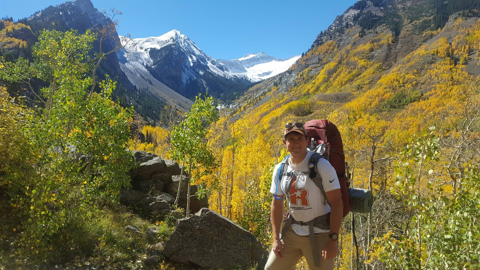
Tuesday, April 21, 2020

Colorado 2018

Trip Summary: June 11 - June 20, 2018
1) Flight to Denver, mountain biking in Avon, and travel to Glenwood Springs
2) Biking on Glenwood Canyon Trail
3) Solo summit of Castle Peak via the North Face Couloir and rock climbing in Glenwood Springs
4) Rest day and mountain biking in New Castle
5) BLM river cleanup and float north of Vail, and Strawberry Days
6) Rock climb 2-pitch, 5.10a, 175 ft "Slabtastic" in East Elks and mountain biking in New Castle
7) Backpack to Snowmass Lake
8) Attempt to climb Snowmass Mountain via East Slopes but turned back and hiked out
9) River float down Glenwood Canyon and Glenwood Hot Springs
10) Travel to Denver and flight home

Sunrise over Snowmass Lake, viewed from the base of Snowmass Mountain.
I first have to make a disclaimer on this post: I started writing this post almost 2 years after the trip itself, so my recollection of events is no longer as strong. However, I will do my best to convey a complete and accurate description of my trip and draw on pictures and video where possible. I had planned this trip to visit Alan and adventure in the mountains of Colorado almost 6 months in advance, but by the time I actually flew into Denver I was financially tight. Staying with Alan, we were able to get up to many adventures outside for free (as we already own the gear), and we made several home cooked meals including burgers and pizza. I think this trip was the lowest-cost mountain adventure trip I've ever been on.

45 ft walls at Earth Treks Golden Climbing Gym.
I flew into Denver on a direct flight and landed at 7:30 am. I was planning on taking the Bustang West Line at 5:15 pm from Union Station to Glenwood Springs, where Alan would pick me up when I arrived at 9:30 pm. Alan lived in New Castle, about 15 minutes away from Glenwood Springs, and worked at the BLM office in Silt. In any case, I had not put any thought into how I was going to occupy myself during the day; I think this was partly because I was so low on money that I simply couldn't afford to do anything in Denver, and so I avoided thinking about it. Once I got off the plane, I sat down and pulled out my phone. I joined the Denver Social Climb Facebook group and posted to see if anyone wanted to go rock climbing. As the minutes ticked by, Alan messaged me and suggested I check out the Earth Treks Rock Climbing Gym in Golden. We also discussed my plan to travel by bus, and he offered to leave work early and drive to meet me in Vail. This would allow me to take an earlier bus which left at 2:45 pm but only went as far as the Vail Transportation Center. He would bring mountain bikes and knew some trails nearby we could ride.

Bustang West Line at Vail Transportation Center.
Armed with a plan, I picked up my luggage from baggage claim and road the RTD A Line train from the airport to Union Station. From there I boarded a RTD W Line train to the Jefferson County Government Center Station and it was a quick half mile walk to the climbing gym from there (but while carrying all my luggage). When I arrived, I checked in and stored my luggage, and started bouldering. The gym was huge! I had never seen a gym this large before. The walls were 45 ft high and routes arched up pillars and across the underside of arches along the ceiling. There were multiple levels of smaller walls, and an extensive bouldering area. I bouldered for quite a while, working on progressively harder problems up through V4.

Mountain Biking in Avon - Wild Ridge Sample Trail (5.5 miles, 1000 ft elevation gain)


Alan and I biking on Wild Ridge Sample Trail.
I ate some snacks I had brought with me for lunch and then packed up and left. After arriving at Union Station, I went downstairs to the bus terminal and boarded the Bustang. It heads out of Denver on I-70 and the drive was beautiful. I arrived at Vail a little before 6 pm and grabbed a burger and fries from a food vendor for dinner. A little while later Alan arrived, and drove a short ways to a trail in Avon called Wild Ridge Sample Trail. We set out a little after 7 pm and made it up onto a prominent hill for a fiery sunset. The sky was lit up in oranges, reds, and yellows from the haze from forest fires. And while we were taking in the sunset, we noticed a grass fire across the creek from where we had parked our car! In just moments, trees were ablaze, and we were concerned the entire hillside, which was populated intermittently with houses, was going to go up as the fire was rapidly spreading. I was also slightly concerned about Alan's car, but within minutes a fire truck arrived and they started putting it out.

Sunset from the ridge - the haze is smoke from forest fires.
The ride was a difficult 5.5 miles, with 1000 ft of vertical elevation gain. At the top of the ridge, Alan pulled a couple of beers out of his backpack. We toasted to another adventure, and after a few sips I immediately started puking. The exertion coupled with beer and the high altitude was not a good combination. After getting a laugh out of my inability to hold down my beer, we raced the enveloping darkness back to the car. We then drove the remaining hour and a half to Alan's house. He had a house with two other roommates, and it was quite spacious and nice. I set up an air mattress, took a shower, and went to bed.

Glenwood Canyon Trail - paved bike path in Glenwood Canyon


Glenwood Canyon Bike Trail.
The next day, Alan rode his motorcycle to work and I borrowed his car to drive in to Glenwood Springs. I loaded up a mountain bike and drove to a neighborhood near downtown. I hopped on my bike and started biking around town, intending to ultimately hop on the Glenwood Canyon Trail. When I got to the river, I ran into another mountain biker and he offered to show me the way to the trail as he had the day off and was also just out biking for fun. We rode an elevator to reach the pedestrian bridge crossing, and continued east along the north side of I-70 through a few tunnels. After crossing to the south side of I-70 and passing through a slightly confusing spot amidst a neighborhood, he then went on his way and I continued biking along the path. I rode to Grizzly Creek Rest Area and then returned. I put in about 20 miles of biking total. I then returned to New Castle and made plans to hike a 14er the next day. Alan came home and we made frozen pizzas for dinner and I went to bed early.

Castle Peak (14,265 ft) - day climb up North Face Couloir Route


View of the other mountains in the Elk Range (Maroon Bells, Pyramid, Snowmass, and Capitol) from the summit of Castle.

The beginning of the hike to Castle Peak.
I set my phone alarm for 2:30 am, but unfortunately slept through it and didn't wake up until 3:45 am. I had wanted to get an early start since I was planning on ascending a snow-only route and I wanted to climb while the snow was still hard. After briefly debating whether I should still go, I decided that since the weather was going to be fair all day that I may as well attempt it. I borrowed Alan's Prius, and set off towards Aspen, a little over an hour's drive, around 4 am. On the way, I realized the energy drink I had downed was inducing some BM, and I started desperately looking for gas stations - but everything was closed as it was so early! I knew of the public restrooms in Wagner Park in central Aspen, and I raced there. Unfortunately they were locked! By that point it was 5:45 am and a Shell gas station had opened, and things were okay.

Waterfall.
I then drove south along Castle Creek Road to the trailhead for the North Face Couloir Route of Castle Peak. Along the way, a brown-haired black bear scrambled across the road in front of me and then squeezed through a wooden fence into the woods to my left. I felt a little bad that I had made him feel such a sense of urgency, since he had some trouble squeezing between the horizontal boards. Once on the other side of the fence, he turned to face me, and I rolled down my window to get a better look. After looking at each other for a few minutes, he started walking away into the woods, and I continued driving to the trail head. After this encounter, I decided to keep the bear spray accessible while I was below the tree line.

The snowfield on the headwall. I ascended left of center.
I parked the car at the lower trailhead and began hiking. The sun was up by now and the trail meandered a long ways through the treeline. I came across a jogger who was one of the few people I saw on the trail all day. After emerging above the tree line, I continued following the jeep trail through a valley around several peaks, gaining significant elevation. I reached a snow-covered headwall and put on my crampons, and eventually came to a bowl below Castle Peak and Conundrum Peak. There was a small, icy blue lake where the snow melt had collected that was simultaneously beautiful and eerie. I found the couloir but could see that the snow did not extend all the way to the summit ridge - there was a gap about 2/3 of the way up. I decided I would try the climb anyways, and try to cross the gap if I could.

Looking up the North Face Couloir.
The couloir was fairly steep, inclined about 40 degrees. An ice axe and traction were definitely required. As I climbed, the snow began to soften in the sun and I found myself postholing up to my knees. I worked towards the edge of the snow to avoid sinking as much, and when I reached the end of the snow I had a decision to make. The couloir was filled with scree, and looked unpleasant to climb with a high risk of rockfall, but I could make out some solid rock outcroppings about 75 feet ahead. I decided to try climbing to that and see
Me climbing up the North Face Couloir.
how it felt, and make my decision there. Once I reached that solid rock, I found myself in the precarious position of being quite scared of what I had just climbed, but completely unwilling to descend. Looking down, the couloir was steep, and down climbing felt more dangerous as my feet would slam into the loose scree with more force than when climbing up. I could see the summit ridge and the standard route trail about 200 ft to my lef tand decided to traverse. I started cutting across the steep face, careful with every step to let the sliding rock settle. When I reached the ridge, I felt a huge relief. That route had definitely melted out for the summer.

Looking down the couloir at the small lake in the bowl below.
From here it was only a few more minutes to climb up the trail along the ridge to the summit. As I approached the summit, I saw a marmot look up at me in surprise and bound away. It was surprising to see such a creature up here at 14,000 ft, but I also noticed a weathered log. The only way it could have ended up there was if someone actually carried that log to the summit. I took in the surrounding views, and could see the other mountains of the Elks a few miles away. The Maroon Bells and Pyramid Peak were prominent in the foreground with their reddish color, and Snowmass Mountain, blanketed in snow, and Capitol Peak both jutted up behind. After texting my girlfriend and Alan, and a quick phone call to my mom from the summit, I then started down the standard route.

Solo summit of Castle Peak (14,265 ft)!
The descent down the Northeast Ridge was much easier than what I had come up. I passed another climber on his way up, and when I reached the snowfield I started glissading. I managed to get two very long glissades, about 1000 ft each, and rapidly descended in minutes what had taken me over an hour to hike up. When I got to the jeep trail, I saw a motorbike. I took off my crampons and started hiking back down. I had thought that I had already consumed my large 3 L Camelbak water reservoir, so I was drinking sparingly from my small 1.5 L reservoir. As such, I was a little dehydrated... and as I found out later, it was for nothing! My 3 L reservoir was full when I got back to the car! Anyways, on my way down I passed a party with two dune buggies were having lunch and enjoying the view of the mountains. They offered me a ride, but I politely declined and continued my hike.

Descending the standard Northeast Ridge route.
A little while later, while I was making my way down the jeep trail and had almost reached the treeline, the dune buggies came up behind me on their way down. "Do you want a ride?" one of the women asked. The guy driving then looked at me as I hesitated and said "Get in!" I had never ridden in a dune buggy before, so I took them up on their offer. I got in the back seat of the second dune buggy, a 4-seater Can-Am. The couple I rode with were visiting their friends who lived in Aspen and owned these 2 dune buggies. I strapped myself into the harness and snapped shut the fabric door and we began driving down. 

The suspension and tires were unbelievable - the ride was smoother than it was walking over the jumbled boulders on this path. I looked over the steep mountainside to my right, as we cruised along bouncing over boulders at up to 8 mph, and it occurred to me that if we slipped off and rolled down the mountainside - my body would probably stay inside the vehicle, but I wasn't sure I would be alive! After a quick creek crossing and faster going on the less rugged terrain below the treeline, we were back at the trailhead. I thanked my new friends and exchanged numbers and pictures, and then started heading back towards Glenwood Springs. I was pretty happy about a successful first solo summit of a 14er! The round trip distance was 13 miles with 4,600 ft elevation gain. After posting a peak condition report on the 14ers.com, Bill Middlebrook commented to say he saw me climbing up and the going looked difficult. He is the founder of 14ers.com and an accomplished mountaineer, and apparently had climbed the Conundrum-Castle traverse while I was ascending. The climb wasn't free from unnecessary risks, however. I reflected on how I had ended up in a situation where going down was less preferable than going up, and how I could prevent ending up in such a predicament again. I think it would be wise in the future to study the standard route as a backup plan if planning on ascending by a non-standard route. I also learned my lesson about snow-only routes: They should only be climbed if they're completely covered in snow!


Puoux - single-pitch sport rock climbing area near Glenwood Springs, CO

Rock climbing.
Alan and his friend Nate were headed to Glenwood Springs for some rock climbing, so I agreed to meet them there. We found a couple of routes in the Puoux area, and I top roped a 5.7. I was too tired to lead or do any more serious climbing, so I kept Nate's dog company and watched them get in another route before dark. We grabbed some ice cream at Kaleidoscoops for dinner and stopped by Nate's apartment, and then drove back to Alan's in New Castle. It had been a very long day and I was exhausted. The next day, I stopped by Alan's BLM office for a quick tour and continued on to the Walmart in Rifle to purchase a new SD card for my phone, a waterproof case for our upcoming kayak trip, and some rain pants which I had left at home in Austin. I then drove back to New Castle and Alan met up with me and we went mountain biking around his neighborhood. We took Medaris Ditch to Salty Dalty and made a loop of Pubview and Medaris Ridge. After a quick shower, we biked to a dinner party with some of Alan's work friends before turning in for the night. 

Upper Colorado River - kayaking and trash cleanup from State Bridge to Two Bridges 
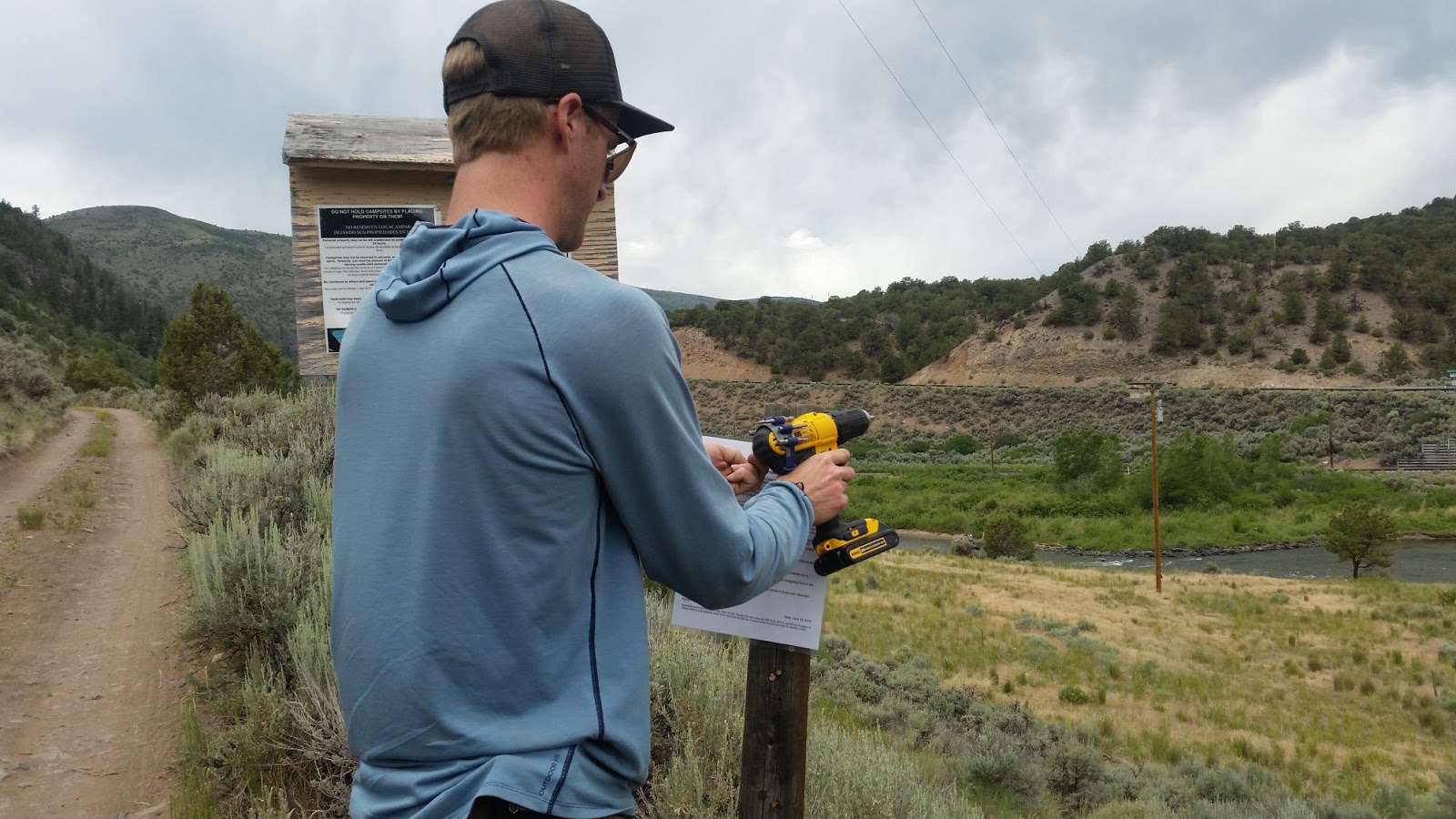
Alan posting a fire warning notice at BLM campsite.
The next day we planned on floating the Upper Colorado River. I went with Alan to the BLM office in Silt, and I registered as a volunteer and we picked up the inflatable kayaks and other gear. Alan and one of his younger coworkers took a BLM truck and I drove Alan's Prius, and we headed east on I-70 to Wolcott and then north on 131 for an hour and a half. This was officially a workday, and I was along as a volunteer - we were tasked with cleaning up some campsites in the area before floating the river, where we would pick up trash and monitor other outfitters operating on the river. When we arrived, we drove through the campsites and cleaned out the fire pits and collected trash into garbage bags. Alan posted a warning related to the fire danger, and then we headed to the State Bridge boat ramp where 131 crosses the Colorado River. We unloaded the kayaks and tasked Alan's coworker with inflating them. Alan and I then both drove to the Two Bridges boat ramp where we planned to pull out in order to leave his truck. We drove back in the Prius and prepared for our river float. Alan and his co-worker would share a double kayaks, while I had the second to myself. Garbage bags, tools, and a repair kit were stored in ammo boxes. We launched our kayaks and began our float.

Alan and coworker kayaking on the Upper Colorado River.
There were a number of rapids, but nothing more than Class 2. The scenery was beautiful. It was fun to be out on the water, especially as I had not yet been kayaking or rafting in Colorado before. We made several stops to collect trash along the riverbank. Just short of 2 hours later (the float was only about 5 miles long), we reached the Two Bridges pullout. Alan's coworker and I packed up the kayaks while he met with some of the outfitters who were also operating there. We then drove back to Silt along the Colorado River Road, which was a very scenic route. 

Alan slacklining.
That evening, Alan and I went in to Glenwood Springs and found a neighborhood park to set up his slackline. After trying for a little while, I started to get the hang of it. Alan's friend Nate showed up, and all 3 of us took turns slacklining before we walked over to Sayre Park for the Glenwood Springs Strawberry Days festival. Alan and Nate met up with some of their friends, and we grabbed some food from the vendors.
Strawberry Days festival.
As night fell, we stayed to watch a concert. It was a fun atmosphere and a great way to spend the evening. We talked with Nate about doing a multi-pitch rock climb the next day and he was down to join. We ended up leaving before the concert was over as we were all so tired.


Slabtastic - 2-pitch, 5.10a, 175 ft sport rock climb in East Elk Creek near New Castle, CO

Hiking along the creek to Slabtastic.
Alan climbing up P1 of Slabtastic.
Nate met us early the next morning and the three of us and his dog drove together up to the approach to Slabtastic. Directions for the trailhead can be found on Mountain Project here. The actual approach to the climb is described here, and took us about an hour although that was partly because we were unfamiliar with the terrain and walking with a dog.

My view up the East Elk Creek Valley from P2 of Slabtastic.
Once we identified the route, I started leading up the first pitch. It was rated an easy 5.7 and about 60 ft high, with 7 bolts. Once I got to the belay ledge, I belayed Alan and Nate up to me. We had 2-way radios for communication as it was easy to climb out-of-earshot and out-of-sight of the belayer. Since we had 2 ropes, we left one of the ropes in place at the anchor for a quick rappel, since the weather looked questionable.

Nate topping out P2 of Slabtastic.
I then lead the second pitch. This is the 5.10a, and it was long (100 ft) and steep. It is protected by 11 bolts. While climbing, I dislodged a rock and yelled to alert Alan and Nate, but they were safe under an overhang on the belay ledge. The rock tumbled to the ground, where Nate's dog Bella was laying, and as a dog, she didn't know what was happening or react to my yell. The rock landed very nearby to her, much to her surprise. Leaving Bella unattended while we were on the wall made me realize that its not the best idea to bring a dog along on a multi-pitch climb if no one on the ground can tend to her. 

Alan, Nate, and I on top of Slabtastic (5.10a).
Several of the moves were pretty difficult. I actually skipped two bolts as I was so uncomfortable with my stance I didn't dare risk clipping. I did use a sling over a protruding rock at one point as a natural anchor to replace one of my skipped bolts as a potential fall could have been huge - maybe 80 ft. As I climbed above the sling, it came loose, but I was able to clip into the next bolt. I cleaned the sling then and there. When I got to the top, I anchored in, and called Alan on the radio to tell him to come off belay. He cleaned my gear on his way up and saw the two skipped bolts. Without any evidence of the natural anchor I'd placed, he thought the potential fall would have been even larger, as there was a long section that appeared unprotected. I'd warned him that if I fell during that section it was going to big, but as he remarked at the top, "I didn't realize how big." We then belayed Nate up to us and we took a few moments on the summit before rappelling down. 

Alan looking over New Castle from the mountain bike trail.
When we got back to New Castle, we said goodbye to Nate before Alan and I did an evening mountain bike ride. We rode Stairway to Heaven, Colorow Trail East, and Colorow Trail Connector. Once back at the house, we grilled up some homemade mushroom and swiss cheeseburgers and packed our gear for an overnight trip to attempt to summit Snowmass Mountain.


Snowmass Lake - backpacking to Snowmass Lake and summit attempt of Snowmass Mountain

Snowmass Mountain and Snowmass Peak obscured in cloud when we arrived at Snowmass Lake.
Alan and I at the Snowmass Creek Trailhead.
Alan and I planned on making our third attempt to summit Snowmass Mountain (14,092 ft). We had first visited the area in 2013 during our backpacking trip on 4-Pass Loop in the Maroon Bells and so we were quite familiar with the area. We drove down to Snowmass Village and parked at the Snowmass Creek Trailhead. We hiked the 8 miles and 2,500 ft elevation gain to Snowmass Lake on Snowmass Creek Trail without too much difficulty. 

Cold and rainy weather throughout the day.
It was chilly and rain showers occasionally swept through the area, but I was fairly comfortable under my rain gear. The creek was high and flowing very fast, and the log jam was almost completely submerged. Remembering how I slipped and fell on the logs in rainy weather in 2014, and with the higher water levels, we opted to ford the creek instead. We stripped down to our underwear, changed into sandals, and held our packs above our heads. We crossed the swift-flowing creek, and the water was icy cold. It was so cold it felt as if it was burning and took my breath away. Reaching chest-deep at its deepest, it was a relief to get to the other side to dry off and put my clothes back on.

Alan crossing the logs to the campsite at Snowmass Lake.
Along the way I saw several very wet looking marmots observing me. They all looked like they could use a warm towel. It is definitely a rough life for the wild animals out here. When we arrived at Snowmass Lake in the evening, everything was still cold and damp and the summit of Snowmass Mountain was obscured in cloud. We set up camp and stored our food in a bear container and went to bed. Unfortunately, sleeping at 10,980 ft, I struggled with altitude sickness. This confounded me as I had been to this place multiple times before, and I had already been in Colorado for a week and I had hoped to have acclimatized. I could not sleep, and my heart was racing. I measured my heart rate multiple times during the night, and it was consistently 150 BPM. I also had a very strong headache that would not go away. 

Snowmass Peak glowing in the sunrise.
In the morning, I told Alan that I had trouble sleeping and that my heart rate was elevated. I still wanted to attempt the East Slopes route though, so we packed our summit bags and hiked around the lake. The brush was still soaking wet from rain and dew, so we wore our rain gear. Halfway from the campsite to the base of the mountain, the first glints of sunrise illuminated the upper slope of Snowmass Mountain and Snowmass Peak in a brilliant orange glow. The summit itself was still obscured by thick cloud and a slight wind disturbed the lake. 

Where we turned around on Snowmass Mountain.
We reached the base of Snowmass just as the sun rose over the mountains behind us. The weather had not improved. We started scrambling and reached just below the waterfall section of the headwall (a gain of about 800 ft) before we stopped again to discuss our situation. The clouds were dark and covered more than 60% of the sky, and the summit was still obscured. My heart rate had still not improved and I was moving slowly. We decided to turn around as my altitude sickness and the weather were not conducive to a summit attempt. Once again we descended Snowmass Mountain having not reached the summit. 

Alan crossing the logjam.
We hiked back to the campsite and struck the tent. We stopped in the lower valley where Snowmass Creek meanders through the meadows and Alan did a little fly fishing. When we reached the logjam, we discovered the water level had gone done a bit and the drier weather made crossing the logs a safe option. It turned out to be a beautiful sunny day, punctuated by thick, white, puffy clouds. The solitude during the walk back through the beautiful aspen forest was some consolation for our missed summit.

Kayaking Glenwood Canyon - 6 mile float on Colorado River from Grizzly Creek to Two Rivers

Alan, Nate, and I launching at Grizzly Creek.
On my last full day in Colorado I packed up my stuff while Alan was work. In the evening, we packed up his roommate's ducky (inflatable kayak) and drove to Glenwood Springs to meet Nate. We left Alan's truck at the Two Rivers boat ramp and piled all our gear in Nate's truck and drove up to Grizzly Creek rest area. Here we put in, with Nate in his own single-person ducky and Alan and I in the double-kayak. This run is 6 miles long and Class 3, and a guide can be found on American Whitewater here. The rapids were fun and it took us about 2 hours to complete. I've biked and driven through Glenwood Canyon several times before, but this was my first time floating the river. In the evening, the sunset made the canyon walls glow in the orange light and it was a beautiful end to my trip. Once we reached the pullout, Alan and Nate went back to Grizzly Creek to get his truck while I deflated the kayaks. I had left my shirt in the truck and the temperature was dropping, so I was pretty cold by the time they arrived. 
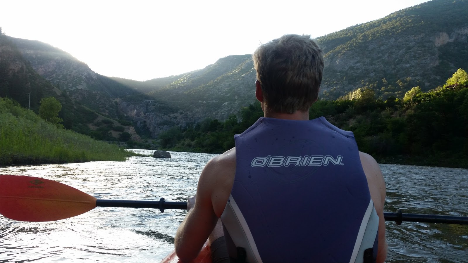
Alan paddling through Glenwood Canyon.
We packed up the kayaks and drove to Glenwood Hot Springs Resort. We got there a little after 9 pm, and the last hour the pools are open for a reduced price of $10. The pools were packed with people, and Alan and Nate ran into several people they knew. But I was able to warm back up, and it was an enjoyable way to end the trip. We said goodbye to Nate and drove back to Alan's in New Castle.

Alan, Nate, and I kayaking Glenwood Canyon.
The next day Alan dropped me off bright and early at the bus station in Glenwood Springs, and I rode the Bustang back to Union Station in Denver. There I was able to take the train to the airport, and flew back home to Austin. It had been a great trip overall. I am thankful to my friend Alan for being such an awesome adventure partner and letting me crash at his place (and borrow his Prius!), and it was fun adventuring with Nate again as well. In the following 2 years, Alan climbed Capitol Peak in the fall of 2018, and finally summited Snowmass Mountain during the summer of 2019, as well as Pyramid Peak. I look forwards to returning to Snowmass Mountain again someday.


Saturday, May 20, 2017

Colorado 2016

Trip Summary: September 20 - September 28, 2016
1) Flight to Denver and travel to Glenwood Springs
2) Hike at Hanging Lake, visit Aspen, and rock climbing at The Narrows in Carbondale
3) Hike at Maroon Bells and rock climbing at Gold Butte in Aspen
4) Visit Glenwood Hot Springs
5) Layover day to prep gear and Alan's birthday dinner
6) Backpack to Snowmass Lake via Maroon-Snowmass Trail and camp
7) Backpack out, visit Doc Holliday's gravesite
8) Climb Mt. Elbert via the Northeast Ridge
9) Travel to Denver and flight home

Golden leaves of the aspen trees at the Maroon Bells.
This was the first time I had experienced Colorado in the fall, and it was stunningly beautiful. The aspens were golden, and all the leaves were full of vibrant colors. Every view was ridiculously beautiful. Did I say it was beautiful? Just astounding.

Alan was working as a seasonal park ranger for the Bureau of Land Management in Silt and was living just outside of Glenwood Springs. This made for a different type of trip logistically, as I flew to Denver from Austin and then took a bus to Glenwood Springs. We used his place as our home base for our adventures. This year we focused on flexibility. We were watching the weather and planning our summit attempts around it. A weather system was forecast to bring freezing rain and snow towards the middle of the trip. Our friends Cole and Darien were also visiting for the first four days, so these constraints put our summit attempt in the latter half of the trip. Alan and I wanted to attempt Capitol Peak, with Snowmass Mountain as our backup.

My friends Adolfo and Kristen were also travelling to Colorado around the same time, but had their eyes on a different mountain. I ended up meeting up with them during the middle of our trip. I had a direct flight to Denver, and ate a late lunch at Root Down in the airport. I took a train to the bus terminal and took a bus to Glenwood Springs. I arrived late in the evening, and Alan, Cole, and Darien picked me up and we had a fun night of shenanigans catching up.

Hanging Lake - hiking near Glenwood Springs, CO
Hanging Lake is nestled high up in Glenwood Canyon.
I started my first morning in Colorado off with a hearty breakfast at the 19th Street Diner with Cole and Darien, while Alan went to work. We then went to Hanging Lake, just 10 miles east of Glenwood Springs. We hiked up to the lake, on a moderately steep, mile-long footpath. The views were gorgeous. A little further up and we were gifted with a view of the Spouting Rock waterfall, where water rushes out of a hole in the rock.


Rock Climbing in the Narrows - single pitch sport rock climb near Carbondale, CO
A little town called Aspen...
A few hours later, we were on the road to Aspen. We walked around the city and visited some of the shops, and I made an impromptu purchase of a North Face insulated jacket. We went for a little walk on a trail out of town up the slopes. Cole was quite excited by the intermittent aspen groves. Alan gave us a call, and we agreed to meet in Carbondale to go climbing at the Watchtower, where we had climbed the previous year.

Rock climbing at the Watchtower in the Narrows.


On our way there, we could see a huge rainstorm washing down the valley of the Crystal River. I had a bad feeling we weren't going to be able to climb, but nonetheless we drove to the parking lot and met up with Alan and his friend Nate. The rain had passed, but we were skeptical that the climbing wall would be dry enough to climb. We decided to hike up to the wall and scope it out. As luck would have it, it was dry. It was running late in the day, so Cole hiked back down to the cars to get some headlamps. I lead on the familiar Night School (5.8, 1 pitch, 60ft). With some slippery rock at the crux, I pumped my arms out and was unable to finish the climb. Nate lead another climb to the right, which was probably "Needs More Cowbell", but is not listed online. At this point the sun had set and darkness had enveloped us, and we were climbing with our headlamps under the night sky. Alan finished Night School, by bypassing the crux to the left, and Nate was able to free it on top rope. I top roped the route and successfully made it over the crux. The other route was also a fun climb, and Cole climbed the routes as well, while Darien cheered us on.

We hiked back down to the cars and jumped in to relax with a beer in the hot springs in the river. There were quite a few other people hanging out in the pools as well. It was a beautiful night with the cold mountain air and brilliant constellations of stars overhead. When we left, I'm pretty sure we drove back to Alan's place and made some frozen pizzas or pasta or something.

Maroon Bells - hiking near Aspen, CO
Darien, myself, Cole, and Alan hiking at the Maroon Bells with Maroon Lake in the background.
The next day Alan took off work and the four of us drove down to Aspen to visit the Maroon Bells, where Alan and I had gone backpacking three years before. We ate lunch at Justice Snow's (again), before taking the shuttle bus from Four Mountain Sports up to the Maroon Bells trailhead. The views were breathtaking. The aspens showered golden leaves onto the forest floor, and the Maroon Bells
The Maroon Bells as seen from the trailhead visitor center.
Alan, Cole, and I being goofy.
towered in the distance. We hiked from Maroon Lake to Crater Lake, which lies below the Maroon Bells. Adolfo and Kristen were attempting to climb Maroon Peak that day. gone missing, and they were searching for him. Despite that sad news, we enjoyed the view of the mountains and the aspen trees at Crater Lake for some time, before hiking back to the trailhead. The round trip distance was ~3.5 miles.
On the hike in, we had seen a rescue helicopter searching the mountain, and I asked a park ranger what had happened. They said a climber had


Gold Butte - single pitch sport rock climb near Aspen, CO
The view of the valley from Gold Butte climbing area near Aspen.
After spending a few hours at the Maroon Bells, we were back in Aspen and headed out of town a few minutes to the Gold Butte climbing area. It was situated overlooking a beautiful valley, and after a quick snack I lead up "Flake Armour", a fairly straightforward 5.6-5.7 on the east face. We left a rope for Cole and Darien to climb the route, and Alan belayed me as I lead climbed "Dusty Ridge Direct", on the arete between the east face and the upper southwest face. It is rated between a 5.6 and a 5.8+, but definitely felt more challenging due to the longer pitch and high winds wrapping around the unprotected southwest face. It was really quite a fun climb. After Cole climbed the route, we then walked around to a route on the upper
Me climbing "Flake Armour" on the east face with Alan belaying.
southwest face that I think was "Hero Loop", a 5.9/10. It was filled with fist sized holes in the rock, but was surprisingly difficult for me to climb. A little over halfway up, I took my first ever lead fall which shook me up a little. In a way, it was good to finally fall on a lead climb, as I had some fear of it ever since I had started leading. Alan was surprised I had never fallen on lead, as he apparently fell just weeks after I taught him. Nonetheless, I was pumped and couldn't finish out the climb, so Alan lowered me down.

Cole descending a top rope climb of "Dusty Ridge Direct".
At this point, the sun had set, so we decided to retrieve our gear by top roping. After hiking up to the top of the cliff, Cole and I belayed Alan over the edge. After he was anchored to the chains, we threw the rope down and I went below to belay him. Cole and Darien went back to retrieve our other rope and gear from the east face, and I belayed Alan who retrieved our gear from "Hero Loop". By the time we made it back to the car, it was dark. On our way back to Glenwood, we stopped in Carbondale for a delicious dinner and beer at Carbondale Beer Works.

Glenwood Hot Springs - hot spring spa on a rainy day in Glenwood Springs, CO
Cole, Darien, and I enjoying the hot springs on a drizzly day.
We woke up the next morning to a gloomy, cold, drizzly day... perfect for relaxing at the outdoor hot spring spa! Cole, Darien, and I (Alan had to work again) went to Glenwood Hot Springs Resort for a relaxing morning of watching the mist slide down the mountains while staying warm in the pool. It was a little uncomfortable knowing that Adolfo and Kristen were out in the mountains somewhere, attempting to climb the Maroon Bells (although, not as uncomfortable as they actually were, huddled in their tent under freezing rain for a few hours before deciding to bail). I was glad to be relaxing and enjoying myself, and planning our summit attempts around the weather. It would have been miserable climbing in those conditions. Aside from the drizzle at lower elevations, the mountains received freezing rain and several inches of snow. Of course, we couldn't see the new snowfall at that time because of the mist and cloud cover.

Celebrating Alan's birthday with Kristen and Adolfo.
After towelling off, we drove up to Silt to visit Alan as he got off work, and Cole and Darien said goodbye. They continued on towards the Black Canyon of Gunnison National Park. The next day, I prepared my gear while Alan went to work, and met up with Adolfo and Kristen in town when they arrived on their bus from Aspen. We went out to lunch at Glenwood Canyon Brewpub where we shared stories of our adventures, and then checked out their AirBnB rental which was downtown overlooking the river and mountain. It was a second floor suite, with a beautiful porch and interior design (marijuana-themed). Later that evening, we celebrated Alan's birthday with dinner at The Italian Underground Restaurant. We then parted ways, and Alan and I headed back to his place to prepare for our backpacking trip and summit attempt the next day.

With the recent snowfall, now clearly visible on Mount Sopris and some of the other mountains, we debated our objective. Alan was concerned about climbing Capitol Peak, a class 4 route on a ridge, with the fresh snow. We came to an agreement that it wasn't in the cards for us this year, and decided we would make another attempt on Snowmass Mountain via the approach from Snowmass Creek Trailhead. We had attempted this route two years before, so we knew the area fairly well. The weather looked stable, and we went to bed feeling confident about what the next day would bring.

Snowmass Lake - backpacking trip on Maroon-Snowmass Trail
Backpacking through the aspen forest along Snowmass Creek.
In the morning, Alan and I drove down to the Snowmass Creek Trailhead. The scenery was magical. Capitol Peak was blazing white, covered in fresh snow. After seeing the snow, I decided to wear my mountaineering boots instead of my hiking boots. I had also purchased a pair of microspikes, and left the crampons at home. We started hiking, and unlike the last time we were here, we were well rested and in good spirits. The Snowmass Creek approach is an 8 mile hike up an elevation gain of 2,600ft to Snowmass Lake. Being familiar with the trail, we didn't stop very much except to take pictures and admire the absolutely stunning scenery. We hiked through the aspen forests and came to the halfway point where we could the backside of North Snowmass. We then continued on through the valley into more open ground, crossed the log jam, and saw a red fox
The scenery was just unreal during our hike.
by the creek. We then followed the switchbacks up into the evergreen forest. We started coming across snow on the ground, which was steaming into the air under the bright sun. When I approached the waterfalls near the lake, the scenery turned to that of a winter wonderland. The ground, the pine trees, everything was covered in snow and gleaming under the sun. My heart was pounding with excitement and appreciation of the beauty around me. For the third time in my life, I came to the shore of Snowmass Lake and took in the majesty of Snowmass Mountain. I'm not sure that there is a more beautiful sight on all the Earth.

Backpacking along Snowmass Creek Trail, with North Snowmass visible across the valley.
Once we arrived, and the initial euphoria of the beauty and the anticipation of climbing had worn off, I began to appreciate the challenge that lay before us. The mountain was fairly dry, with a few inches of snow part way up. Having been on the mountain before and familiar with the talus and scree, Alan
Alan walking along the creekside trail where the valley opens up.
and I both realized this was quite possibly the worst possible condition to climb in. There was enough snow to cover some of the holes between individual rocks, but not enough to just walk right over the scree fields and avoid tripping and falling. We each took some time to think about the situation, and we ate our dinners on our own. We had both packed a homemade chicken, hummus, spinach wrap, and it was nice to eat real food in this remote area. Since we were alone, all of the campsites were open. We set up my new four season tent in the same campsite we had used every time we had been there. It was cold, but nonetheless we set about tasks such as replenishing our water supply.

Alan crossing the log jam over Snowmass Creek.
The insoles of my feet were pretty sore, and when I took off my boots I saw why. I had developed huge blisters on the inside arches of my feet. This, combined with the light snow, factored in to our reluctant decision to abort our attempt of Snowmass Mountain. We made little snowmen, and I broke out two mini bottles of Maker's Mark whisky and we toasted to Alan's birthday. We brewed some hot tea, which did wonders in restoring energy and happiness, but I don't recommend spiking it with Maker's Mark. With our food stowed in a bear cannister, we stowed our bags away from
Alan enjoying dinner on the shore of Snowmass Lake.
camp and watched the sun set behind the mountain. We briefly considered packing up and hiking out in the middle of the night to attempt another mountain early in the morning, but once asleep, our 3am alarm had no chance of rousing us. We slept in until sunrise.

In the morning, we shook the ice off the tent and broke it down. Alan went ahead to do some fishing at the ponds in Snowmass Creek in the valley on the hike out. I finished packing up, took a final look at the mountain which was beckoning me under the clear blue sky, and turned around and hiked back out. I met up with Alan while he was fly fishing, and after catching a trout or two, we finished backpacking out. Despite our disappointment at being foiled by Snowmass once again, we were happy to be in this place. We were alone, or very near alone, in this part of the wilderness. The sky was clear, the air was cold, and the views unbeatable.

Snowmass Mountain and Snowmass Lake with fresh snow and clear blue skies.
We drove back to Glenwood Springs and met up with Alan's friend Arnel. We went to visit Doc
On the trail with Alan and Arnel to Doc Holliday's grave.
Holliday's grave, which was an interesting and easy hike. The cemetery was in remarkable shape considering how old the tombstones were. We then met up with some more of Alan's friends at Glenwood Springs Brew Garden to watch the Presidential Debate between Hillary Clinton and Donald Trump. Arnel and I agreed to attempt to climb Mt. Elbert, Colorado's highest fourteener, the next day while Alan was at work.


Mt. Elbert (14,433ft) - day climb up Northeast Ridge Route near Twin Lakes, CO
Arnel with his truck at Independence Pass.
Around 6am in the morning, Arnel picked me up from Alan's and we set off in his pickup truck towards Mt. Elbert. We drove over Independence Pass and then continued on to the Twin Lakes. We initially drove up a 4x4 only road that I realized was not the approach we were intending to start from. When we turned around, there was a truck blocking the road. He had broken a U-bolt, and his axle was barely staying attached to the truck as he finally backed out of our way. We continued on to the trailhead for the Northeast Ridge route and started hiking at noon. After reaching the treeline, I realized just how far we still had to go. The climb is a Class I and basically follows a
Arnel at the treeline during our ascent of Mt. Elbert.
footpath, with minimal scrambling, all the way to the top. There were several false summits, and Arnel was climbing slower than me. We had cell phone service the entire time, and I made phone calls to my girlfriend and my parents while waiting for Arnel to reach me. At 3:30pm, we had hit my hard turn-around time if we wanted to be back before dark. At this point, I ran through my options in my mind.

I had to leave early the next morning to catch a bus back to Denver in order to make my flight
home. I also wanted to be back in the evening to see Alan. But I also wanted to summit Mt. Elbert, and it was a beautiful day. I knew that the weather was going to be stable, and I had plenty of clothing, food, and water. I now regretted leaving my headlamp behind, a choice I made to 'save a few ounces' since I thought there was no way we would be out after dark. I learned that lesson. I also knew it was going to be a new moon that night, as I was going to be racing in the Harvest Moon Regatta during a Full Moon two weeks later. I checked my phone and saw that I had plenty of battery life left, so I decided we could use our phone screens for light. Given the situation, I decided to keep climbing, fully aware that we would be hiking down in the dark.

Summited Mt. Elbert (14,433ft) at 6pm!
I waited for Arnel at the summit ridge, and we walked up to the summit together. The view of the vast land around us was amazing. I could see Snowmass Mountain, Capitol Peak, and several other mountains that I recognized. It was 6pm when we summited and the sun was beginning to set. The light cirrocumulus clouds turned an orange-red as the sun began to set. The mountains cast huge shadows across the valley floor. After taking a few minutes to enjoy the view on the summit, which was Arnel's first fourteener, we then began our rapid descent.

On my way down, I ran into a climber running up the trail. It turned out he was the guy we had run into earlier that had broken his U-bolt on his truck. He had it towed to town, fixed it, and drove to the trailhead and hiked up. He was obviously moving much faster than us. I wanted to make it to the treeline by dark, and I figured we had about one hour of twilight. Once we made it to the treeline, the darkness was complete. I messaged Alan and let him know our plans around 8pm, and we started hiking down through the forest. Arnel walked behind me, holding on to my backpack, as I flashed my phone screen to illuminate the trail. After glowing for a few seconds, it would turn off, and I continued walking from memory for a few more seconds before turning on the screen again. We talked the entire way down in order to alert any nocturnal animals to our presence. Arnel also carried a handgun, although I wasn't really sure what good that would do us in the pitch black if we did need it. Nonetheless, I felt pretty comfortable with the situation, and once my phone died I used Arnel's. After two hours of hiking in the pitch black darkness, we made it back to the truck.

Descending Mt. Elbert under the beautiful sunset.
We were both pretty exhausted after spending 10 hours hiking, and we still had another two hours or so to reach Glenwood. Once I got back, Alan was already asleep, and I packed up my stuff and finally hit the hay at about 2am.

Waking up at around 5am, I had breakfast with Alan before he drove me to the bus stop. I said goodbye, and rode the bus back to Denver. Since I was a little early, I had lunch at Wynkoop Brewing Company in downtown Denver where I enjoyed a grilled salmon club sandwich washed down with craft beer. I then hopped on the train to the airport, and flew home.

This trip to Colorado was unique, as it seems every trip is. I felt that we had made good decisions (except leaving my headlamp behind) and I felt revitalized with the positive energy I feel when I go to the mountains. This trip had been a little more laid back, but we did everything in style. And the fall colors, the snow, and the scenery could not be beat. It was good to meet up with so many of my friends. I also went through a difficult time in my relationship with my girlfriend during this trip, and being in the mountains helped me see things more clearly. There is no better environment for finding peace than in the mountains, and for finding happiness than surrounded by good friends. Check out the video below: