1) 4-day backpacking trip at Four Pass Loop in Maroon Bells-Snowmass Wilderness near Aspen, CO
2) Mountain biking Emerald Mt. (6 mi) and Rabbit Ears to Storm Peak (24 mi) in Steamboat Springs, CO
3) Day hiking at Mount Zirkel Wilderness in Steamboat Springs, CO
Four Pass Loop - 4 day backpacking trip in Maroon Bells-Snowmass Wilderness near Aspen, CO
There is a lot of available information out there on backpacking Four Pass Loop. It is a 28 mile loop in the Elk Range that wanders through stunning mountain scenery, but it is a difficult hike and much of it is above 9,000ft. We used this trail guide provided by the Aspen Ranger District, and there are many trip reports on Summitpost.org and 14ers.com. I went with a group of three other guys, Alan, Ahmed, and Omar, and while the loop can be done as a backpacking trip in three days, we took four days to do it. I highly recommend taking four days, especially if you are coming from low altitude. I don't know why you would want to skip through that place in three days as the scenery is so beautiful. That said, this loop can be done as a trail run, and the record is 4 hours and 27 minutes.
 |
| Topo map of our trip at Four Pass Loop. We went clockwise, Maroon Lake to West Maroon Pass direction. |
Before driving up to Colorado, I gave the Aspen Ranger District office a call to ask about snow conditions. The ranger told me that the mountain passes were impassable with over 10 feet of snow, and he didn't expect conditions to improve for several weeks. I scrambled to come up with an alternate trip, but before changing our plans, I talked to Alan. He had been in Colorado the previous winter, and he told me that Colorado had a light snowfall that year and didn't believe what the ranger told us. I called back again, and received the same answer, but after calling a third time, someone different picked up the line. He told me that while it was still early in the season, he didn't think there was much snow. With that information, we set off on our trip, planning on going as far as we could and turning back if we had to. As it turned out, all of the passes were passable, and we only had to cross a few snowfields.
We had originally planned to hike Four Pass Loop in 5-6 days, stopping along the way to climb Snowmass Mountain. By the time we got there, we were pretty exhausted, and since only Alan and I were interested in climbing, we decided not to climb. This turned out to be a good decision as we were not prepared for the climb, lacking helmets to protect us from falling rock and ice axes and crampons to deal with the snow that covered the upper half of the mountain. Alan and I are planning on returning this summer to climb Snowmass Mountain and Capitol Peak, armed with the proper gear.
 |
| The car was so full of stuff we stowed our food on the dash. |
-Breakfast: Oats, energy bars
-Lunch: Energy bars, beef jerkey, dried fruit,
trail mix, candy
-Dinner: Dried foods (stuffing, scalloped
potatoes, mac+cheese, pre-packed camp food, etc.)
Equipment:
Backpack (55-85L)
Pack rain cover
Hiking boots
Sandals (for stream crossings)
Carabiners and straps as needed
Hydration reservoirs (150oz+), and/or water
bottles
Headlamp (and extra batteries and possibly even an
extra headlamp)
Sleeping pad
Sleeping bag (and compression bag)
Knife
Sun glasses
Trekking
poles (optional)
Compression shorts (or other moisture-wicking
underwear)
Hiking socks
Short-sleeve shirt (moisture-wicking, NOT
cotton)
Shorts (exercise-type, I use mountain bike
shorts)
Long hiking pants (NOT jeans)
Base shirt layer (Under Armor mock or similar)
Long underwear top (PolyPro or similar)
Long underwear bottoms (PolyPro or similar)
Polar fleece (lightweight)
Soft-shell jacket
Raincoat
Winter hat
Baseball hat (or other hat for sun protection)
Rain
pants (optional)
Mountaineering socks (optional)
|
Toothbrush, toothpaste, floss, deodorant, soap
(all small travel versions)
Chapstick
Chamois (to use as a small towel)
Bowl, spoon/fork, cup
Ditty bags, Ziplock bags, and hard case (for camera or other electronic items)
Camera (and
batteries) (optional)
Glasses,
contact case, contact solution (as needed)
Hearing aid
batteries, any other personal items (as needed)
Backpacking tents (depending on number of people in group and how many they can sleep)
Backpacking stove (and fuel)
Lighter (and/or matches)
Rope (for hanging packs)
First-aid kit
Water filtration
Bear mace
Bear bell
Maps (and compass)
Aspirin (for altitude)
Sunscreen
Bug spray
Cooking pot
Ladle or spoon (for cooking)
Toilet paper
Sewing kit
Water jug (Reliance)
|
Day 1 - June 25, 2013
 |
| Alan, me, Omar, and Ahmed at the trailhead at Maroon Lake. |
 |
| Me cooking stuffing for dinner over a campfire. |
Day 2 - June 26, 2013
 |
| View of the valley from the top of West Maroon Pass. |
 |
| Our 2nd campsite in the valley behind the Maroon Bells. |
Day 3 - June 27, 2013
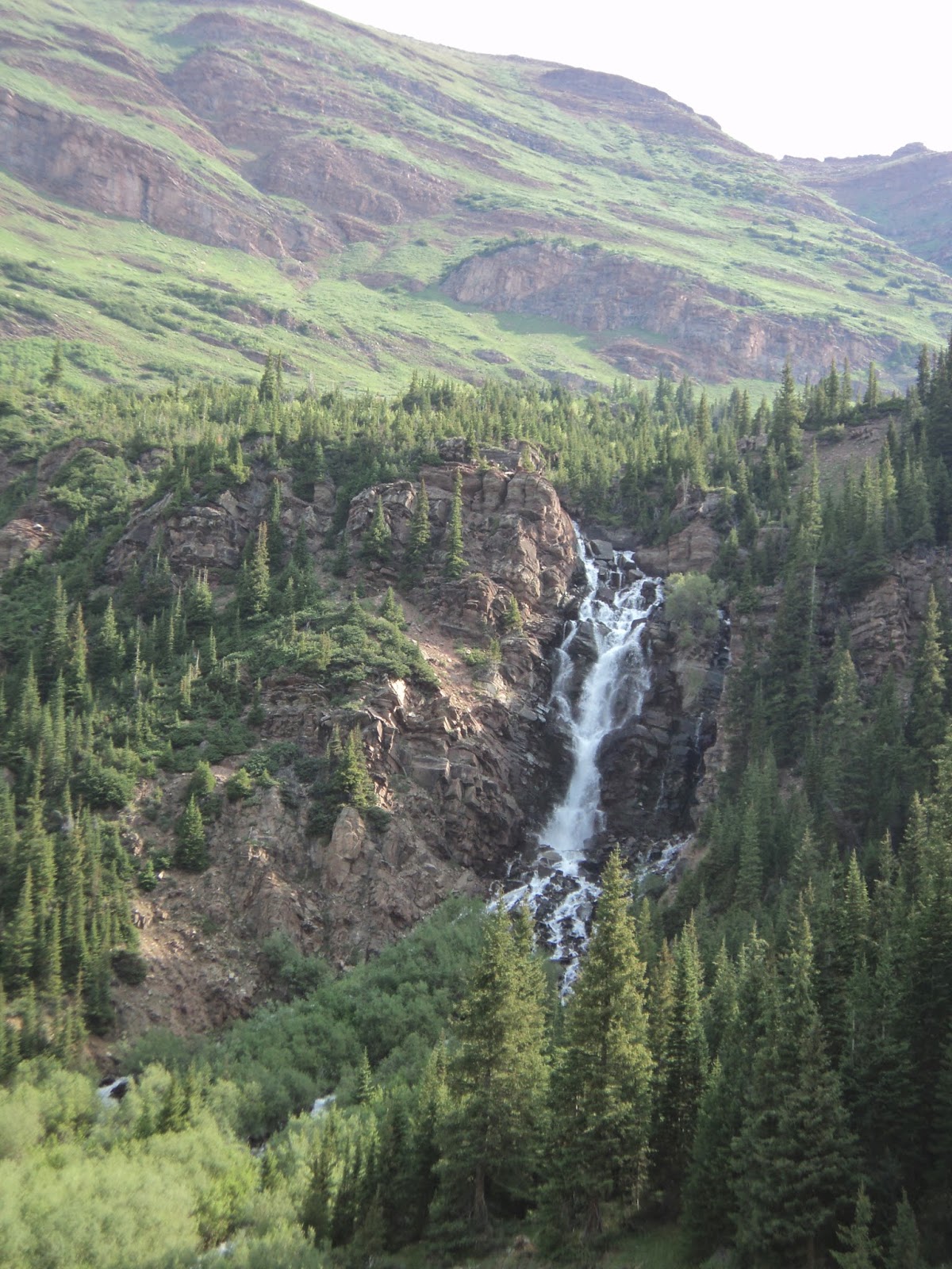
With an early start, we hiked down into the lower part of Fravert Basin, where a large, beautiful waterfall tumbles to the valley floor. The trail follows the valley floor to the base of the North Fork Cutoff Trail, at which point it switchbacks up the side of the mountain. The trail emerges above the treeline on a plateau, where Trail Rider Pass is visible several hundred feet higher. This pass was quite difficult, but we made it to the top in good time. Snowmass Lake is visible on the other side of the pass. A word of caution on the descent towards Snowmass Lake - the slope is quite steep. The trail switchbacks, but a few rocks that Alan knocked loose rolled down for what seemed like forever until they hit another rock and exploded into tiny fragments. The pictures below show, from left to right; the waterfall in Fravert Basin, Trail Rider Pass, snowfields on the descent to Snowmass Lake, and Snowmass Mountain across Snowmass Lake.
We also had to traverse some snow on a steep slope during our descent. We had much more energy today as we were starting to acclimate. We made it to camp early that afternoon around 4:00pm, and set up our tent on a campsite right next to the lake. Some forest rangers came over and told us to move to a campsite farther away, as we had forgotten that campsites need to be a minimum of 100 feet from water. Alan broke out his fly fishing rod and caught some trout, while I explored and found some cool waterfalls downstream of our campsite. Since we didn't have a stove, and fires are not allowed near Snowmass Lake, we ate cold Ramen noodle soup. In cold water, the noodles did not absorb much moisture, so they remained crunchy. The first bite was delicious, as it was salty and filled our stomachs, but it quickly became very unappetizing. I do NOT recommend ever eating cold Ramen noodles. We filtered our water and went to bed.
Day 4 - June 28, 2013
The Maroon-Snowmass Trail approach of the west side of Buckskin Pass is absolutely beautiful. We made it to the top of Buckskin Pass by 10:00am, and were rewarded with a beautiful view of Snowmass Mountain. We hiked back down towards Maroon Lake, and encountered a light thunderstorm when we were about 2 miles from the trailhead. The light rain was quite refreshing, and the lightning was striking much higher in the mountains. We were thankful that we were already down in the valley, however, as we had seen several people heading up to the pass just before the storm. High mountain passes are not the place to be during a thunderstorm. We hiked back to the trailhead and took the bus back to our car. We had lunch at Justice Snow's, a burger bar someone had recommended to us during our trip. We then drove to Glenwood Springs and stayed at Cedar Lodge. We had a great time and I highly recommend this backpacking trip. It is relatively remote, and it is difficult, especially if you live at low altitude and don't spend time acclimating.
 |
| Maroon-Snowmass Trail. |
 |
| Buckskin Pass. |
 |
| Snowmass Mountain in the distance. |
 |
| Back at the Maroon Bells trailhead! |
 |
| Hitching a bus ride back to Aspen. |
Mountain Biking in Steamboat Springs - Emerald Mt. (6 mi) and Rabbit Ears to Storm Peak (24 mi)
 |
| Mountain biking at Emerald Mountain. |
We biked up Emerald Mountain on June 29, 2013. From the rodeo grounds trailhead, the trail we took was about 6 miles roundtrip and 1500 feet vertical elevation gain. We took about an hour and a half to go up, and bombed back down in about 20 minutes, taking a short break to let Alan's disc brakes cool. The downhill makes the climb worth it. As Alan told me on the way up, "Nothing worthwhile is ever easy." You can view a map of the trails on Emerald Mountain here. That evening, we went to Strawberry Park Hot Springs and had dinner at Mahogany Ridge Brewery and Grill. We also saw a moose while looking for a campsite. We ended up staying at a motel.
 |
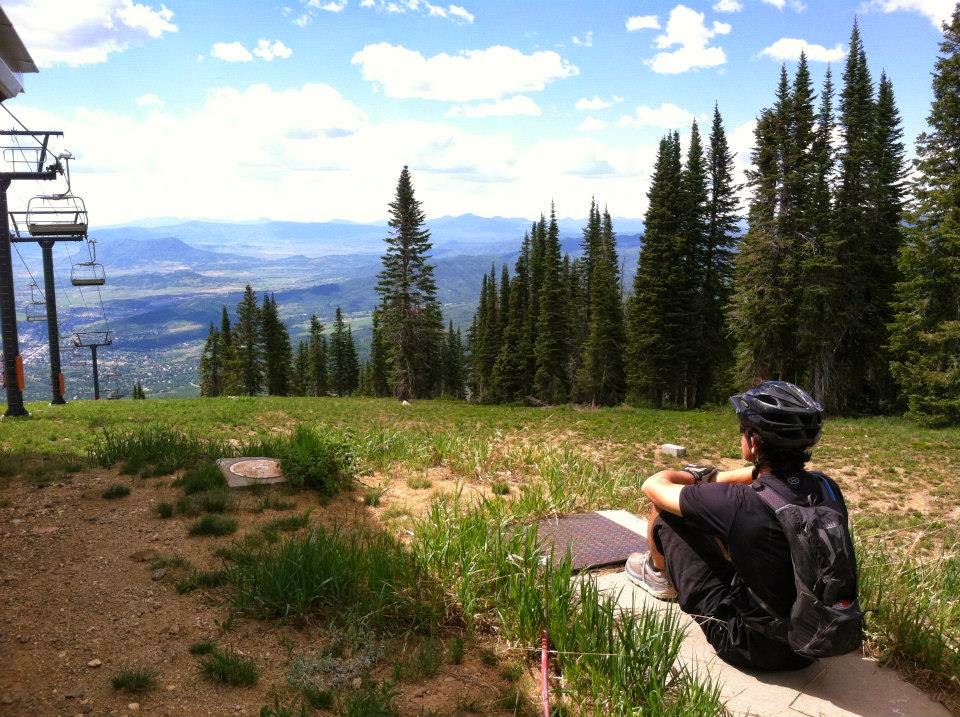
| View of Steamboat Springs from the top of Storm Peak. |
Mount Zirkel Wilderness - Gilpin Lake Trail, a 9 mile day hike near Steamboat Springs, CO
 |
| Gilpin Lake in the Mount Zirkel Wilderness. |
We had dinner at Carl's Tavern and spent the evening in Steamboat Springs, before driving to a hotel near Denver. We made it back to Texas the next day. This trip had turned out to be an epic adventure! Alan and I are already planning to return to climb Snowmass Mountain and Capitol Peak this summer. If you get the chance, I highly recommend visiting any of these areas. Thanks for reading my trip report and I hope you enjoyed it! Check out the video Alan made of our trip below:


No comments:
Post a Comment